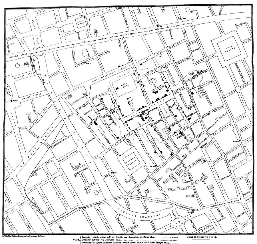
John Snow's Cholera Map

by Us National Library Of Medicine/science Photo Library
Title
John Snow's Cholera Map
Artist
Us National Library Of Medicine/science Photo Library
Medium
Photograph - Photograph
Description
John Snow's cholera map. Map of Soho, London, UK, showing deaths (black lines) due to cholera during the epidemic of 1854. This outbreak killed 616 people. At the time it was thought cholera was caused by 'bad air'. However, the British physician John Snow (1813-1858) believed it was spread by contaminated water. This map showed that cases were centred around the water pump on Broad Street (now Broadwick Street). Snow convinced the council to disable the well by removing the handle, leading to a decrease in cases. Image from 'Report on the Cholera Outbreak in the Parish of St James, Westminster, During the Autumn of 1854' (published in 1855).
Uploaded
February 22nd, 2021
Embed
Share


