
Boundary: Bleed area may not be visible.


by George Bernard/science Photo Library
$41.95
Model
Case Style
Orientation
Image Size
Product Details
Map Of Ottoman Empire In 17th Century iPhone case by George Bernard/science Photo Library. Protect your iPhone with an impact-resistant, slim-profile, hard-shell case. The image is printed directly onto the case and wrapped around the edges for a beautiful presentation. Simply snap the case onto your iPhone for instant protection and direct access to all of the phone's features!
Design Details
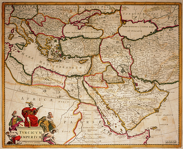
Ottoman empire. A map of the Middle East by Frederick de Wit, c. 1689. During the 17th century most of eastern Europe, the Middle East and North... more
Ships Within
3 - 4 business days
Protect your with an impact-resistant, slim-profile, hard-shell case. The image is printed directly onto the case and wrapped around the edges for a beautiful presentation. Simply snap the case onto your for instant protection and direct access to all of the phone's features!
Ottoman empire. A map of the Middle East by Frederick de Wit, c. 1689. During the 17th century most of eastern Europe, the Middle East and North Africa was governed from Istanbul by the Muslim Ottoman empire.
Science Photo Library (SPL) is the leading source of science images and footage. Sourced from scientific and medical experts, acclaimed photographers and renowned institutions, our content is unrivaled worldwide. Outstanding quality, accuracy and commitment to excellence are deeply embedded in our DNA. Science Photo Library inspires creative professionals and delivers engaging content of the highest quality for a wide range of clients in a variety of sectors. Visit sciencephoto.com for more information and stay connected on Twitter, LinkedIn, Instagram and Vimeo.
$41.95


Copyright © 2024 sciencephotogallery.com - All Rights Reserved - Website Powered by Fine Art America / Pixels - Original Source - Tapestries


There are no comments for Map Of Ottoman Empire In 17th Century. Click here to post the first comment.