
Boundary: Bleed area may not be visible.

Inside Message (Optional)
Inside View

by Nasa/goddard Space Flight Center Scientific Visualization Studio/science Photo Library
$5.00
Quantity
The more you buy... the more you save.
Orientation
Image Size
Product Details
Our greeting cards are 5" x 7" in size and are produced on digital offset printers using 100 lb. paper stock. Each card is coated with a UV protectant on the outside surface which produces a semi-gloss finish. The inside of each card has a matte white finish and can be customized with your own message up to 500 characters in length. Each card comes with a white envelope for mailing or gift giving.
Design Details
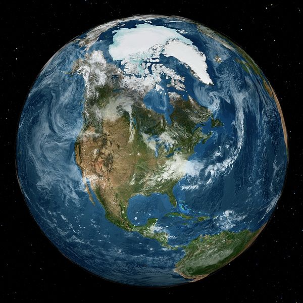
Arctic and North America. Satellite image of the Earth with the full Arctic region visible. The sea ice is at its minimum annual extent in the... more
Ships Within
2 - 3 business days
Arctic and North America. Satellite image of the Earth with the full Arctic region visible. The sea ice is at its minimum annual extent in the northern hemisphere. Sea ice data is from the AMSR-E (Advanced Microwave Scanning Radiometer-EOS) instrument on the Aqua satellite. The land and cloud data is from the MODIS coverage by the Terra and Aqua satellites. The star field is from the Hipparcos satellite. This image was obtained on 21 September 2005, and released to mark the International Polar Year.
Science Photo Library (SPL) is the leading source of science images and footage. Sourced from scientific and medical experts, acclaimed photographers and renowned institutions, our content is unrivaled worldwide. Outstanding quality, accuracy and commitment to excellence are deeply embedded in our DNA. Science Photo Library inspires creative professionals and delivers engaging content of the highest quality for a wide range of clients in a variety of sectors. Visit sciencephoto.com for more information and stay connected on Twitter, LinkedIn, Instagram and Vimeo.
$5.00


Copyright © 2024 sciencephotogallery.com - All Rights Reserved - Website Powered by Fine Art America / Pixels - Original Source - Tapestries


There are no comments for Arctic And North America. Click here to post the first comment.