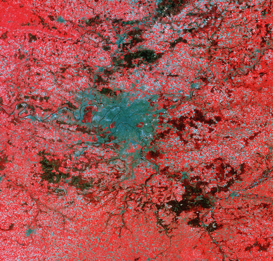
Landsat Image Of Paris

by Mda Information Systems/science Photo Library
Title
Landsat Image Of Paris
Artist
Mda Information Systems/science Photo Library
Medium
Photograph - Photograph
Description
False-colour Landsat image of Paris and environs. In this image buildings appear as blue/grey, fields appear as red and woodland appears as brown. The black line of the River Seine snakes from bottom right to centre left, its junction with the River Marne being at the right (east) end of the city, next to the red patch of the Bois de Vincennes. At the left (west) edge of the city is a large dark red area, the Foret de St. Germain, bounded within a meander of the Seine. Within the light red area on the southern edge of the city, the bright runways of Orly airport may be seen. Resolution in this image is about 30 metres.
Uploaded
September 12th, 2018
Statistics
Viewed 509 Times - Last Visitor from Seattle, WA on 04/21/2024 at 3:20 PM
Embed
Share
Sales Sheet
Comments
There are no comments for Landsat Image Of Paris. Click here to post the first comment.


