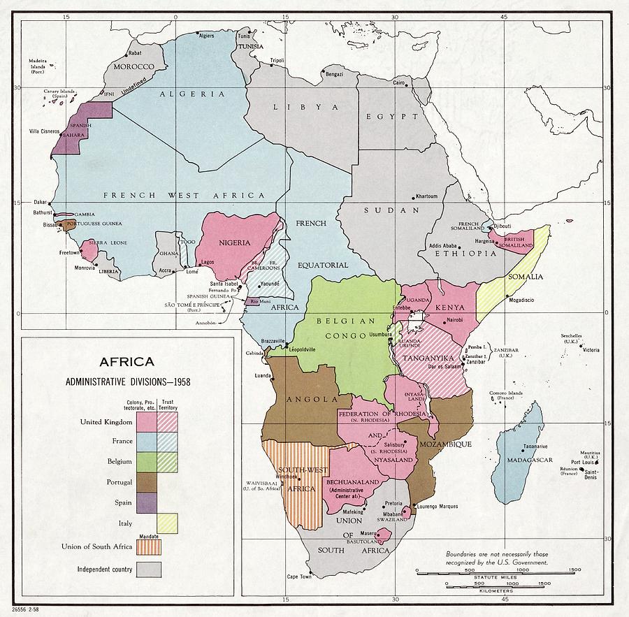
Administrative Divisions Of Africa

by Library Of Congress, Geography And Map Division
Title
Administrative Divisions Of Africa
Artist
Library Of Congress, Geography And Map Division
Medium
Photograph - Photograph
Description
Administrative divisions of Africa. Political map from 1958 showing colonies, protectorates, territories, mandates and independent countries in Africa. European countries that still ruled or controlled large areas of Africa were the UK (pink), France (blue), Belgium (green), Portugal (brown), Spain (purple) and Italy (yellow). Ghana declared independence in 1957. Egypt became a republic in 1953. Morocco became independent in 1955, Libya in 1951, and Sudan and Tunisia in 1956. From 1958 to 1960, a further 25 countries would become independent, followed by a further 26 by 1980. Published in the USA by the Central Intelligence Agency (CIA).
Uploaded
August 4th, 2016
Statistics
Viewed 1,510 Times - Last Visitor from Fairfield, CT on 04/18/2024 at 8:05 PM
Embed
Share
Sales Sheet
Comments
There are no comments for Administrative Divisions Of Africa. Click here to post the first comment.


